
ODNR's Office of Coastal Management Publishes Updated Lake Erie Public Access Guidebook
SANDUSKY, Ohio – The Ohio Department of Natural Resources (ODNR) Office of Coastal Management released a fully updated Lake Erie Public Access Guidebook, a resource for exploring Ohio's 312-mile Lake Erie coast. This 348-page publication includes a detailed listing of all public parks, nature preserves, wildlife areas, beaches, boat ramps, fishing piers, and scenic vistas.
In addition to coastal sites along Ohio's Lake Erie shore, the guidebook also includes locations situated on the major rivers flowing into Lake Erie. Altogether, the publication highlights 201 Lake Erie public access sites and 320 sites located along the 14 major river systems that flow into the lake.
The guidebook offers in-depth site information for each location, including site descriptions, amenity icons, trail names, maps, and photographs, as well as details on how to access the water at each site.
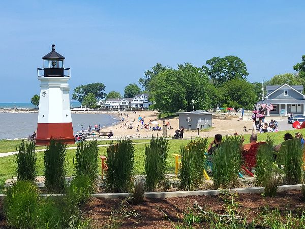
The Lake Erie Public Access Guidebook is an excellent resource for exploring all 312 miles of Ohio's Lake Erie coastline, including Main Street Beach in Vermilion.
The updated Lake Erie Public Access Guidebook (LEPAG) combines information previously published in two separate volumes: the LEPAG Coast Edition from 2014 and the LEPAG Rivers Edition from 2013. This new edition consolidates all public access details into a single, comprehensive resource.
Free copies of the guidebook will be available to the public starting this summer at more than 30 locations in the Lake Erie coastal region while supplies last. A complete list of distribution sites can be found at coastal.ohiodnr.gov. The full document can be downloaded by chapter on the Office of Coastal Management webpage.
ODNR ensures a balance between wise use and protection of our natural resources for the benefit of all. Visit the ODNR website at ohiodnr.gov.